217
výsledků v rámci
Místo
 Bankeryd socken
Bankeryd socken
Socken i Småland
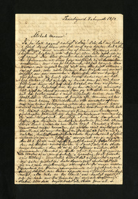
Albert Edelfelts brev till Alexandra Edelfelt från Granbäck den 2 augusti 1872, 4 sidor.
8 m ÖNÖ about country road.; VSV slope of height Wooded land with a chalice.
Domarring, 4 - 5 m diam consisting of 7 rested lumpstones, 0.2- 0.45m h, 0.4 - 0.6 m br and 0.35 - 0.5 m tj. A stone on the VNV edge is cracked in two parts. The buoy with several pines, two birches and a spruce bushe.0.5 m ÖNÖ if #1 is: 2. Rest stone, ……
Grave fields, approx. 16 x 8 m (Ö-V), consisting of approx. 5 ancient remains. These were 1 ring of judges and 1 square stone circle and 2 ev. 3 lumpstones. The header ring, located in NV, is 4 m diam and consists of 6 lumpstones, several of which are in …
Rocking?, almost irregular, 5 m diam and 0.3 m h. Icon aerial dried, otherwise overmosed stones, 0.2 - 0.5 m pcs. Unequal, coarse surface. Most likely residue of antiquity.6 m SÖ if no 1 is: 2. Forward-like submission. See the inventory documents. OBS.……
A protected oak tree. OBS. Free-external is not quality assured. Information may be missing or incorrect.; Excerpt of the Register of Natural Memorial, Jönköping County, No. 19.; Land.
Hill, about 60 x 60 m pcs, with name and tradition. OBS. Free-external is not quality assured. Information may be missing or incorrect.; Ek. rec. 1954. -- Additions The collections of SOA 1952 have height.
Motif height Forest land (coniferous forest).
Dry fittings after the sun ship Hagen enl. homestead association survey. Possibly, traces of the settlement can remain at the edge rune. Not inspected 1985 due to lack of time OBS. Free-external is not quality assured. Information may be missing or incorr…
Saml of SOA: r 1952. -- Oak. 1954. -- Leisure map F 231: The towel hall board of Bottnaryds IF 1976 has symbol of the source with runoff towards SÖ and well 40 m NÖ thereon.
Rocking?, residues of, irregular, 5 x 3 m (VNV-ÖSÖ) and 0.3 m h. Filling, slightly overripened, of 0.15 - 0.4 m pcs stonemasI Ö a lumpstone, 0.6 m pcs. NV thereon is a pair of m l continuation of the stonecack. Adjacent and S if the pierced road is a co……
Rocking?, residues of, irregular, 5 x 3 m (VNV-ÖSÖ) and 0.3 m h. Filling, slightly overripened, of 0.15 - 0.4 m pcs stonemasI Ö a lumpstone, 0.6 m pcs. NV thereon is a pair of m l continuation of the stonecack. Adjacent and S if the pierced road is a co……
Bankerydsbygden in pictures from before. Bankeryds homestead association skr. 3.1978, p. 30 and 60 with photo.; 17 m V on road reasons.
The place of a island farming island, in operation in the later part of the 16th century and the first part of the 17th century and in addition to the manufacture of muskpipe also made harnesk.Enl. peat. the map also spinneri here and V the dry Bruket.N……
The place of a island farming island, in operation in the later part of the 16th century and the first part of the 17th century and in addition to the manufacture of muskpipe also made harnesk.Enl. peat. the map also spinneri here and V the dry Bruket.N……
Road holding stone, removed. OBS. Free-external is not quality assured. Information may be missing or incorrect.; The poem.
Road holding stone with inscription facing V: SCARE. OBS. Free-external is not quality assured. Information may be missing or incorrect.; 1 m V about road, about 20 m N about NÖ corner of plot and ca10 m NV about exit.
4 m S arable edge/-gip and 3 m ÖNÖ about country road. Boundary knee.; The VSV part of small impediment. Road edge.
Forest Party, approx. 300 x 200 m (Ö-V) with name and tradition. OBS. Free-external is not quality assured. Information may be missing or incorrect.; A “local thief” who was stolen in the neighboring villages and was therefore held behind the back by the …
1-3. A. S. Sunesson in a letter to the National Antiquities 28/7-1931, ATA. -- 3.Banknote images from before. Bankeryds homestead association, 1976, p. 64.; 1. Adjacent and NÖ if Inown.; A fairly smooth moraine shelf between lake and height massif. Forest…
Dry plamps? after Soldattorpet Häggeberg enl. homestead association survey. Enl. The collections of the Swedish Ortnamen archive are namentTorpet names on rides. OBS. Free-external is not quality assured. Information may be missing or incorrect.; Impedime…
Drying plans after the hill hut (peg) or the pit (Sunesson1931) Åkershult with now insignificant and wooded remains. OBS. Free-external is not quality assured. Information may be missing or incorrect.; Bankeryds homestead association peat inventory map No…
Dry fittings after the sun dry The black deer. Ca 25 - 30 m N about No 1 and about 25 m N about the bend against NV of the road is: 2. Lift drying oven, about 2 x 1 m (Ö-V) and 0.75 m dj. OBS. Free-external is not quality assured. Information may be mi……
Border branching between Flasarp, Granbäck and Ransberg.; The VSV side of height and Z about overgrown mosses. Forest land.
